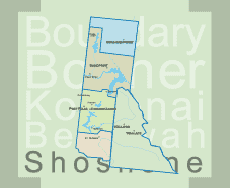
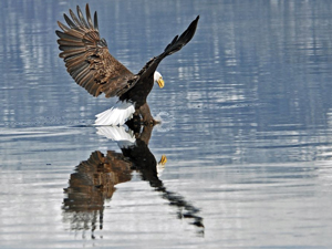
• Post Falls Dam

  • Photographed by Tom Holman

Continental Creek Trail #28
LENGTH: 2.3 miles (one way)
SKILL LEVEL: Intermediate to Difficult
SEASON: Late June to October
Restrictions: Closed to ATVs.

Continental Creek Trail #28

This is a very scenic trail providing a strenuous workout with its many switchbacks down from Rd. #1013 through an old growth cedar stand to the river bottom. Huckleberries, thimbleberries, devils club and ferns grow thick along the trail.

Once to the river, the trail leads to an open flat area which offers an excellent camping spot. The trail then crosses a fork of the Upper Priest River and follows it to the falls near the Canadian Border.

A short section of the trail near the falls, which climbs above the river, is steep and lacks tread. This may cause difficulty for some to hike the full distance to the falls. Use caution.

Directions:

North on Hwy 57, Hwy 57 turns into graveled Forest Service Rd. #302, approx. 4 miles past Nordman. Travel north on Rd. #302 approx. 11 miles until it turns into Rd. #1013 at the Granite Pass junction. Continue north approx. 25 miles. Trailhead is near the end of road on your left and just before the locked gate. Trail ends up at Upper Priest River Falls, also known as the American Falls. Road past 308 trialhead not recommended to stock trailers due to rough road and tight switchbacks.

Print Email

Lookout/Mullan Pass Loop
Route Directions:
Exit I-90 at the Wallace Exit 61.  The ride starts across from the Visitor’s Center.  You will climb 2495 ft on this ride.

Mileage
0.0    This trail connects with the Trail of the Coeur d’Alenes when you get under I-90.  Continue East under I-90.
0.5    Wallace Trailhead.
1.8    Restless Rapids Wayside
3.6    Golconda Wayside
7.3    Mullan Trailhead.  Looking east, you will see a paved trail between the large brick building on your left and the "Yuppie Trails" store on your right. Follow this through town as you first approach and then join Earle Street, which appears on your left.
7.8    Ride past the ball park , join the I-90 Business Loop road present on your right, and pass by the freeway interchange, following the sign to "Shoshone Park." Proceed past the Lucky Friday Mine and over a Willow Creek to an important fork in the road.
9.0    Turn right on Willow Creek Rd.  If you continue to the left, you can get to Shoshone Park and the Hale Fish Hatchery where you can also find the Northern Pacific route to Lookout Pass.  This route is shown on the map in orange.  It is 4 miles longer, but is an easier climb.
9.6    You are on the last overpass in Idaho.
10.6    Junction of Willow Creek Rd and the Northern Pacific route trail.  Continue on the Northern Pacific route.
11.9    You just passed the site of the remnants of the Dorsey trestle and now can see the concrete foundation for old Dorsey Water Tank.
13.3    Site of the remnants of the second trestle.  Almost to the top.
15.6    Top of Lookout Pass.  Cross over I-90, then take the road to the right.
15.8    Go around the gate, and take the next left.
16.1    A high spot across I-90 from the ski area parking lot.
16.3    Trail turns away from I-90.
16.5    Trail is into the woods.
17.1    Trail has crossed over into the S. Fork Coeur d’Alene River valley.
17.5    The single track climbs onto an old logging road that is fairly level for a ways.
18.3    Spur road goes down to meet Mullan Pass Rd and single track climbs away from the spur road.  Stay on the single track.
18.6    Nice view of the valley.
19.1    The trail here is a blend of spur roads and bits of single track.
19.6    Turn left onto Mullan Pass Road.  It is all downhill from here to Wallace.  Stay on Mullan Pass Road past Shoshone Park.  Continue back into Mullan.  Return to Wallace on the Trail of the Coeur d’Alenes.
36.0    Back at the starting spot across from the Wallace Visitor’s Center.

Print Email

Bernard Peak Loop

Bernard Peak Trail is a 18.3 mile non-motorized mountain Bike trail in Athol, Idaho. Open all year round until snow or muddy conditions apply usually good from May to November.
This ride includes a non-motorized trail, Bernard Peak Trail (#37), Old DoubleTrack, Forest Roads, Local gravel & paved roads. Most of the ride is on State and National Forest Land. A small section is on Stimson Lumber Company Land. Stimson allows ORV access.

The trail offers great views of the surrounding back country of the Panhandle National Forest along with majestic views of Lake Pend Oreille. Smooth, fast rolling singletrack with great climbing doubletrack. There is not much traffic in this area except during the fall hunting season from September to December. This is a very rewarding ride. Enjoy!

A lot of riders prefer to ride up to Bernard Peak using the Bernard Peak Trail and then turn around and come back down the same way. Farragut State Park is connected to this trail system, which offers some great riding as well and also a great swim. Stop in at the towns of Bayview or Athol and enjoy some good local burgers!

Trail Directions
Start at the parking lot located at the end of Twete Road. (Stimson Lumber Recreation parking lot). Ride counter-clockwise. Follow your App to the Bunco ORV/Powerline Trailhead (self explanatory). This allows for a good warm-up on the paved section for a few miles.

Turn Left onto Trail 6 at the 4.8 mile mark. You are on your way to a great climb. This climb will get your legs pumped! Stay on the main doubletrack all the way to the top of the ridge. There are a few old double tracks that take of Trail 6.

Trail 6 is an old doubletrack that consists of packed dirt, loose sand sections (depending on rain fall and season) and rocky segments. Their are some short, loose, technical rocky sections as you cross under the power lines and get closer to the top of the ridge line. Once on top of the ridge at the 9 mile mark, you'll dead end into Forest Road 2707. Take a left onto Forest Road 2707 and continue due North toward Bernard Peak. After riding approximately 100 yards you'll come to a junction. Take a left at the Junction onto Forest Road 2708. After riding approximately 1/4 mile, there will be another junction. Stay left here and continue on Forest Road 2708. You'll encounter a couple of more spur roads that go off to the right, but stay Left on FS 2708 to the top of Bernard Peak. As you approach the top, you'll start seeing the surround mountain tops.

Here, you'll find the Upper trailhead to Bernard Peak Trail (Trail #3) on the south side of the mountain top. It is labeled Trail #3. There is a sign nailed into a tree as well as a trail marker. Pass up the trail for now and head to the top of Bernard Peak (about a 1/4 mile). Take some time to rest up, dry off your sweat drenched shirt and grab some food. You just climbed a little over 2400 feet and have 11.25 miles on your legs. Take some time to enjoy the views. Walk up to the tip top of the mountain where an old fire lookout use to stand back in the 1950's. Take in the southern mountain range of the Chilco Mountains.

Go down the Bernard Peak Trail (Trail #3). You can go back down the Forest Road to the trailhead or go down the southern slope. The southern slope is steep, rocky and technical, so be cautious.

The Bernard Peak Trail (Trail #3) dives off the Forest Road 2708 on the south side of the Mountain about a 1/4 mile from the top. It then follows the southern sloping ridge. You'll then encounter a large, swooping 180 degree turn which points you in the northern direction taking you across the western slope of the mountain, which leads you onto the cooler and more lush north face. You'll spend the rest of your time on the north side of Bernard Peak.

This trail is fast, fun and energizing with many swoops, turns and a handful of switchbacks and creek crossings. You'll find yourself grinning ear to ear on this trail. Stop off at the overlook at around the 14 mile mark and catch a great view of Pend Oreille Lake, the town of Bayview and the surrounding mountains, then continue bombing down the trail. At the 16.1 mile mark you'll be at the end of the Bernard Peak Trail (Trail #3). This marks the end of the Forest Service land and now you'll be on Stimson Lumber land. You'll transition onto old doubletrack from here.

You'll head downhill for about 300 yards and eventually reach an old junction. Turn left here and continue on the old doubletrack. At mile mark 16.8 you'll encounter another junction, stay left and continue on. The doubletrack will now be turning into more of a forest road. At mile mark 17.4 take a right and continued to follow the road. You'll encounter a small uphill grade to a gate. Go around the gate, it's now time to shift to high gear and get the tires moving and bomb down to the Stimson Lumber parking lot.
Pure, local, backcountry awesomeness!


History & Background
From 1914 to 1976, a Forest Service Lookout stood on top of Bernard Peak. It was a part of a chain of Fire Lookouts that were constructed in the Panhandle National Forest.

Farragut State Park is located Northwest of Bernard Peak and joins the trail system. The Park was a Military Training Camp during World War 2. Visit the Visitors Center, The Old Brig and read the many signs in the park. Very interesting place with lots of history.

Farragut State Park

Address: 13550 ID-54, Athol, ID 83801
Management: Idaho State Parks and Recreation
Phone: (208) 683-2425
Founded: 1964, 53 years ago


Print Email

Idaho whitewater rafting

Idaho whitewater rafting offers more whitewater river miles than anywhere in the lower 48 states and scenery unlike any other with more than 3,100 miles of whitewater rivers. Trips are offered on a dozen rivers, including the Snake through North Central Idaho - Hells Canyon (the deepest gorge in North America) and the main Salmon, dubbed the “River of No Return” by early explorers. Hells Canyons is breathtaking. It is often said that the rapids are second to the awe-inspiring feeling of being deep in a canyon with steep walls resembling those found in the Grand Canyon. If you are looking for the complete rafting experience, then explore the many Idaho whitewater rafting trips.

What a thrill to be bumping through rapids with names like The Grim Reaper, County Coroner, Bloody Mary, Killer Fang and Ten-Pin Alley, named because the river bounces riders around rocks the way a bowling ball bounces pins.

You don’t have to be a thrill seeker to enjoy the sport as many outfitters have trips suitable for children. Idaho whitewater rafting trips vary from one to seventeen day adventures, due to the remoteness of the rivers. Many trips are designed for families looking to expose their children to the wonders of the Great Outdoors. It is not uncommon to see eagles, bighorn sheep and other wildlife. There is also great fishing available. Some feature camping along the water; others include overnight stays at comfortable lodges. Some trips combine boating with hiking, biking and horseback riding; others cater to hunters and fishermen.

One of the most stimulating rafting trips is on the Lochsa (pronounced lock-sah) which rises near the Montana border, runs west along U.S. Highway 12, then joins the Selway to form the Clearwater River east of Lewiston. The Lochsa,(a Shoshone word for “rough water”) one of the state’s wilder rivers with mostly Class III and Class IV rapids (Class V is considered unrunnable), many other rivers offer the fun of boating without as much risk, or sweat.

On the Lochsa, the minimum age is 15, primarily because everybody has to be able to paddle. The paddling, in fact, is somewhat difficult as you are supposed to do it in unison.

Bruneau River Rafting Trips (Class III-IV):
The turquoise waters of the Bruneau River run for 40 miles through a tall canyon of red rock reminiscent of Bryce and Zion National Parks. River trips last four days with beginner – intermediate Class III-IV rapids.

Clearwater River Rafting Trips – Middle Fork (Class I-II):
A relaxing scenic float through the Selway-Bitterroot Wilderness. The Clearwater River offers great wildlife viewing and mild whitewater.

Hells Canyon Rafting Trips – Snake River (Class III):
The Hells Canyon rafting on the Snake River consists of beginner – intermediate Class III-IV rapids. River trip options include rafting 34 miles in three days or 82 miles in six days.

Lochsa River Rafting Trips (Class IV):
Over 40 rapids in 20 miles makes the Lochsa River one of the best options for adventure-seekers anywhere in the United States. This free-flowing, springtime run is one of America’s first Wild and Scenic rivers. On the Lochsa, the minimum age is 15, primarily
because everybody has to be able to paddle. The paddling, in fact, is somewhat difficult as you are supposed to do it in unison.

Moyie River Rafting Trips (Class II-III):
Just a short distance from the charming town of Sandpoint, Idaho, the Moyie River is a delightful and fun one-day rafting trip. Bouncy waves are a good introduction to whitewater and the scenery is stellar.

Salmon River Rafting Trips (Class III-IV):
There a several multi-day trips offered on both the Main Salmon River and the Middle Fork of the Salmon River. Flowing through the remote Frank Church Wilderness, the Salmon is known for excellent fishing, wildlife, and hotsprings.

Selway River Rafting Trips – Lower Section (Class I-II):
A free-flowing mellow springtime run, the Lower Selway is a spectacular scenic rafting trip with a few mild rapids. Wildlife viewing, birding, and fishing are excellent on the Lower Selway River.

St. Joe River Rafting Trips (Class II-III):
The St. Joe River is located in the panhandle region and runs through one of Idaho’s most lush and spectacular forests. The whitewater on the St. Joe is fun and exciting and is great for beginners or experienced rafters.


Print Email