• Post Falls Dam

  • Photographed by Tom Holman

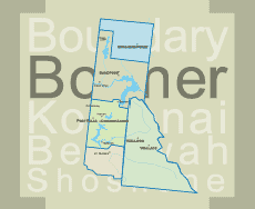
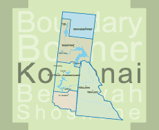
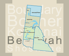
Navigation Trail #291 (Priest Lake)
LENGTH: 8.1 miles
ENDURANCE LEVEL: easy
SKILL LEVEL: All
RESTRICTIONS: Open to foot traffic only


Navigation Trail #291

An adventure on Priest Lake isn’t complete without hiking Navigation Trail #291. The trail passes through valley and side hill terrain. Along the trail there is an old trappers cabin, beaver ponds, abundant wildlife and breathtaking scenery.

Developed campgrounds located at the north end of Upper Priest Lake (Navigation Campground) and the south end of Upper Priest Lake (Plowboy Campground).

Directions:

1) At Nordman turn east onto Reeder Bay Road. Stay on the main road approx. 14 miles to Beaver Creek Campground. Turn right toward the campground then left uphill to the trailhead. Pull-through park available for trailers.

2) North on Hwy 57, Hwy 57 turns into graveled Forest Service Rd #302 approx. 4 miles past Nordman. Travel north on Rd. #302 approx. 14 miles until it turns into Rd. #1013 at the Granite Pass junction. The road to the trailhead is on the right side, located 5.5 miles up Rd. #1013. (1 mile past the Hughes Meadows turnoff.) Stock trailer parking available.

3) Trail can also be reached via Plowboy Mountain Trail #295.


Navigation Campground is located on the northwest shores of Upper Priest Lake, with majestic views of the Selkirk Crest. Four campsites are furnished with fire rings, picnic tables, and bear-proof storage boxes. Please note that this site has a Pack It In, Pack It Out policy on all garbage.

Beaver Creek Campground is situated on the shores of Priest Lake at an elevation of 2,500 feet, shaded by hemlock and cedar. Priest Lake consists of the main lake, where most water recreation takes place, and the smaller Upper Priest Lake to the north. The two lakes are divided by a narrow channel.


Print Email

Lakeshore Trail #294 (Priest Lake)
LENGTH: 7.5 miles
ENDURANCE LEVEL: easy
SKILL LEVEL: All


LAKESHORE TRAIL #294

This is a very popular and well-used trail. It traverses the west shoreline for approx 7 ½ miles from just north of Granite Creek to Beaver Creek Campground. It is an easy trail that crosses five streams and has many grand views of the lake and the Selkirk Crest situated on the east side of the lake. There are numerous access points to isolated beaches that make great picnic locations.

Directions:

At Nordman, turn east onto Reeder Bay Road.  Follow Reeder Bay Road/ USFS Road #2512 for approx 4.7 miles. The first of four designated trailheads is on the right side of the road with two additional trailheads further up the road with the fourth at the south end of the Beaver Creek Boat Launch. The trail is designated for foot, mountain bike, and horse traffic.


Print Email

Kalispell Island Trail #365 (Priest Lake)
LENGTH: 2.5 miles (one way)
SKILL LEVEL: easy
SEASON: Memorial Day - Late October
RESTRICTIONS: Open to foot traffic only

Kalispell Island Trail #49

This trail is an extremely easy hike around Kalispell Island. The trail runs along the back of campsites, so staying on the trail is important.

Directions:

Off of Highway 57, turn (milepost 31¼) onto Kalispell Bay Road. Travel approx. 1 mile and turn right onto the West Lakeshore Road towards the Priest Lake Marina. Just past the marina turn left at the Kalispell Bay Boat Launch.

This trail is only accessible by boat. Boaters can access the island by going to Kalispell Vista or Sandy Point Day Use areas. Once on the island, the trail can be accessed from any point.


Print Email

Scotchman Peaks Trail #65 (East of Sandpoint)
LENGTH: 4 miles one way 8 miles total
ENDURANCE LEVEL: Elevation gain is 3,700 feet.
SKILL LEVEL: Strenuous because it is steep.


Scotchman Peaks Trail #65

This is the “grand-daddy” of hikes in the proposed wilderness, an annual pilgrimage for many local hikers. The trail is a little over 4 miles one-way, but the elevation gain is 3,700 feet. This is a short climb, but strenuous because it is steep.  The well worn trail tread is usually in good shape and leads to the highest point in Bonner County, the top of Scotchman Peak.  Stunning panoramas of Lake Pend Oreille begin at “the meadows”, about two thirds of the way up and they continue to unfold as you reach the summit.  The peak looks over, and deep into, the rugged valleys and ridges of the Scotchman Peaks area.  Mountain goats are frequently encountered on the surrounding ridges and near the summit.  Snow lingers late into the summer of most years.

Directions:

Take Highway 200 (east from Sandpoint) and in downtown Clark Fork turn north at the Chevron Station.  Go past the school and continue up Mosquito Creek Road #276 to the junction of Road #2295.  Turn right and go a little over a mile.  Watch for signs for Trail #65. Turn left on road 2294.  Turn left next on 2294A. Follow this a little over a mile to where the road ends at the trailhead.  Look Up

Download a map of Scotchman Peak


Print Email