


Albeni Falls Dam is located on the Pend Oreille River between Oldtown, Idaho, and Priest River, Idaho. It is located on the site of a natural waterfall named Albeni Falls, named after early pioneer Albeni Poirier.
Albeni Falls Dam was authorized for construction under the Flood Control Act of 1950. This Act was signed by the United States Congress in response to a great flood that swept over the river valleys of the Columbia basin in 1948. Albeni Falls Dam was built from January 1951 to December of 1955 at a total cost of $34 million. It produces over 200 million kilowatt hours of electricity each year for the Bonneville Power Administration and is operated by the U.S. Army Corps of Engineers. The dam is 90 feet (27 m) high and 775 feet (236 m) long. Its spillway is 400 feet (120 m) long.
The dam is made up of two different parts: the powerhouse and the spillway. The powerhouse contains powerful turbines and generators that convert gravity-driven river water into hydroelectricity. The spillway can either store water for downstream power production and irrigation at other dams along the Pend Oreille and Columbia Rivers, or release water for upstream flood control. There is 136,000 cubic yards (61 million pounds) of concrete in the structure.
Today, it produces over 200 million kilowatt hours of electrical energy each year. When running at top capacity, the three Kaplan generators can generate 42.6 megawatts. That's enough power to supply about 15,000 homes. Bonneville Power Administration markets this electricity to customers primarily in the Pacific Northwest. This power production saves the United States from buying about 4.9 million barrels of imported oil each year.
Albeni Falls Dam offers guided tours and has a visitor center
Nearby:
Lake Pend Oreille (Ponderay)
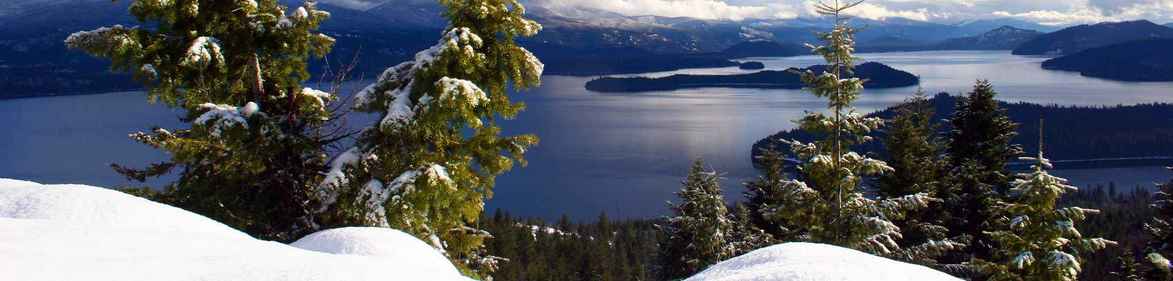
Lake Pend Oreille is one of the largest and deepest natural lakes in North America. Spanning near 150 square miles, it extends through a glacially carved, U-shaped valley that separates three lofty mountain ranges-the Cabinets, Selkirks and Coeur d’ Alenes. Rimmed by these mountains that rise over 6,500 feet, the lake’s average depth is 545 feet, but in some areas plunges to a depth of 1,237 feet.
The shoreline of the combined Lake Pend Oreille and the Pend Oreille River is 226 miles. It’s length 68 miles, with a maximum width of 6 ½ miles.
The name “Pend Oreille” derives from the French name for a local tribe of Indians that wore pendant ornaments in their earlobes.